Thursday, March 11, 2010

Abbey's country


For myself I'll take Moab, Utah. I don't mean the town itself, of course, but the country which surrounds it -- the canyonlands. The slickrock desert. The red dust and the burnt cliffs and the lonely sky -- all that which lies beyond the end of the roads.

-- Edward Abbey, "The First Morning," Desert Solitaire

We chased Abbey's ghost around the southwest, but of course it was in Arches where we felt his presence the most. When we first drove through town on our way to Canyonlands the day before, I looked at Main Street for some sign of familiarity from my visit back in '98, but found none, not even the Arby's where I bought lunch, until we reached the bridge over the Colorado River. I'm not sure why, but I remembered that Arby's, how I bought a chicken sandwich and curly fries (the only reason I stop at Arby's) to go and took my lunch up the road to the little park along the Colorado, just beneath that bridge. The Arby's is gone, apparently, and they're renovating the bridge, and it turns out I remember little from my previous short stay in Moab.

And that includes Arches. I remembered the entrance road that runs alongside U.S. 191 and I recalled the visitors center, but I had no memory of the steep climb the park road makes alongside the redrock cliffs, winding its way up into the big rock garden that is Arches. My memory was of the road once you finish the climb, when it opens up to a vast vista to the south, over the petrified sand dunes to the La Sal peaks on the horizon. I remembered the road curving around Park Avenue and running alongside the Great Wall, and the turnoff at Balanced Rock for Double Arch, the Windows and Turret Arch.

Desert Solitaire was the reason I first came to Arches, and after short-changing myself on that initial visit -- I believe I only was in the park from mid-morning to mid-afternoon and didn't hike the path to Delicate Arch -- I was determined to give Casey, on her first visit, and myself a full day this time. As part of my preparation, I brought both Desert Solitaire and The Journey Home. My reading of them -- the second time for Solitaire, my first for Journey -- bridged the stay in Moab, and I found that reading them after visiting the places made the images in my mind much more vivid. As a result, the time spent felt more rewarding, because I was better able to put myself in Abbey's shoes than if I'd read the books before the trip. I found it easier to recall the park while reading the book than to recall the book while in the park.

So after re-reading Abbey's account of his first morning in the park and searching a bit online, I deduced the location of the house trailer where Abbey spent his summers as the steward of Arches National Monument, as it was then. I could've asked a park ranger, as that article mentions, but what's the fun of that? So before turning right after Balanced Rock to explore the Windows, we made a left on to the unpaved road that rises a hump to a picnic area and then becomes uneven and rutted as it slopes down toward Willow Flats. It then continues several miles through the backcountry and crosses Courthouse Wash before meeting Highway 191 eight miles north of the current entrance to the park. This dirt path through the desert was Abbey's way in and out of the park.
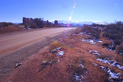
Abbey's view? I may have been wrong, but not far from the turn off the main -- paved -- road, near the picnic area, just before the Willow Flats road deteriorated, was a clearing that currently held a few concrete barriers and other maintenance tools. It looked like the kind of clearing where a house trailer may have stood during the park's more primitive days. But the clincher, to me, was the view. This spot sat atop a bluge in the land, with Balanced Rock a few hundred yards away, the La Sal range off on the southeastern horizon and the crux of the park -- Devils Garden, the Fiery Furnace, Delicate Arch -- off to the north. Abbey described this vantage point in his book, and with the road quickly descending past this point, I didn't see another clearing that would offer the views that Abbey had.

Abbey would probably loathe the fact that the paved park road passes so close to where his trailer sat, cutting him off from Balanced Rock and the arches past it, not to mention that the picnic area and pit toilet on the park map (PDF) may be where Abbey built his ramada, the covered-from-the-sun, open-on-the-sides patio to escape the confined heat of the trailer when summer reached the Utah desert.

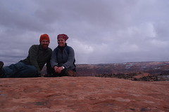
We then drove out to the Windows parking area, passing Ham Rock on the way, and finding a relatively full lot. We walked the loop trail, stopping first to explore Turret Arch, passing through it to the other side and catching the bearded man beneath it for the photo above. I took two shots for perspective, keeping one in color and converting that one to black and white after seeing it on the computer; it wasn't until looking at it that night in the hotel room that I saw the resemblance to Abbey in profile and knew I'd just taken one of the iconic photos of this trip and one of my favorite shots, ever.

Back through Turret, we followed the path to a fork where the path on the right goes to the South Window, the left path to the North. Two women and several small children -- walking slowly -- went right; we went left. The North Window looks out on a view like that from Mesa Arch, though the drop-off through the arch isn't so sudden; you could pass through and descend to follow a path through the backcountry. Even if you don't, the vista in front of you is a reward in itself: small canyons and rock spires scattered about the desert, leading off to Salt Wash in the distance.

Two views Double Arch sits nearby, unchanged and sitting in the perfect morning light seen on the WPA poster. Somehow, I missed this one back in '98, too, even though it lies a short walk from the parking area. If I did take the time to see it, I didn't take any photos, or I don't remember them. On that trip, I do remember weighing more time at some places vs. more places, but less time. I didn't have a hard end date for my trip, but I knew I wanted to try to meet my family in Maine in August. And so I told myself that it was OK if I cut a visit short -- it just meant I'd leave something to come back to see.

On the park road again, we turned to head deeper into the park, first driving past Wolfe Ranch to the Delicate Arch viewpoint, a short if at times steep trail that gives you a view of Arches' -- and one of Utah's -- most famous and iconic spots, though you're a mile away on the other side of a 500-foot abyss. It was a brief glimpse from the other side of what was to come after lunch. I basically planned the morning according to the photography suggestions in the park newsletter. After a look at Delicate Arch and a quick stop at Wolfe Ranch for some photos with the right light, we drove back into Moab to refuel with burgers at Milt's Stop and Eat.
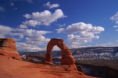
At the amphitheater Fortified with beef and cheese and tots, we returned to the park and began the mile-and-a-half trek to Delicate Arch. It's an arduous and varied hike, first through the brush around Salt Creek, then up a small switch-backed rise and down and up again as you approach the long climb up the sandstone, where Abbey noted that the legions of tourists have left a noticable path from cairn to cairn on the rock. At the top of this stretch, the walk becomes more pleasant, winding and dipping and rising slightly again through a pleasant collection of rock formations, juniper, sagebrush and damp, muddy pockets. The final push covers a ledge cut out of a cliff -- on the shadowy side, so that much of where we trod remained covered in snow and ice, but thankfully it angled in toward the cliff wall rather than out toward the slope.

And then, you're there. I shouldn't have even tried to describe it myself; Abbey does a fine job of it:

Many have made the climb to Delicate Arch, so many that the erosion of human feet is visible on the soft sandstone, a dim meandering path leading upward for a mile and a half into a queer region of knobs, domes, turrets and coves, all sculptured from a single solid mass of rock. What do the pilgrims see? The trail climbs and winds past isolate pinyons and solitary junipers to a vale of stone where nothing has happened for a thousand years, to judge from the quietude of the place, the sense of waiting that seems to hover in the air. From this vale you climb a second ledge blasted across the face of a cliff, round a corner at the end of the trail and Delicate Arch stands before you, a fragile ring of stone on the far side of a natural amphitheatre, set on its edge at the brink of a five hundred foot drop-off. Looking through the ring you see the rim of Dry Mesa and far beyond that the peaks of the La Sal Mountains.

There are several ways of looking at Delicate Arch. Depending on your preconceptions you may see the eroded remnant of a sandstone fin, a giant engagement ring cemented in rock, a bow-legged pair of petrified cowboy chaps, a triumphal arch for a procession of angels, an illogical geologic freak, a happening -- a something that happened and will never happen quite that way again, a frame more significant than its picture, a simple monolith eaten away by weather and time and soon to disintegrate into a chaos of falling rock. ...

If Delicate Arch has any significance it lies, I will venture, in the power of the odd and unexpected to startle the senses and surprise the mind out of their ruts of habit, to compel us into a reawakened awareness of the wonderful -- that which is full of wonder.
We sat up there for a good half-hour, at least, and could've stayed longer, but there was more we wanted to see. Our stay happened to fall within the departure of some of the more voiciferous people who had been there before us and we left just as a new collection of hikers arrived; for the most part, we had a quiet and serene stay for ourselves.

Though there were the two items that slipped from their owners' grasps and rattled down the rock into the amphitheater: a plastic water bottle one couple accidentally kicked down the slope as they stood up to leave, and the camera lens of a photographer who had been crouching in a small level ledge a few feet below where we sat. I nervously watched him taking his shots, his boots holding him onto the sandstone slope. When he shimmied back up to his jacket and started changing lenses, I further questioned his judgement. And then, as I was drawing Delicate Arch in my notebook, I heard the sound of metal and plastic bouncing off the red rock. I looked down, he looked up, and I said, "That didn't sound good. Was it a lens?" He nodded: "Guess I'm going for a hike."

He walked around to the base of Delicate Arch, then sat on the slope and considered whether he could get down into -- and back up from -- the bottom of the amphitheater. It forms a basin, with a patch of soggy sand -- including rather recent footsteps -- a juniper and some sagebrush. At the opposite end, it appears to connect to more stable ground, perhaps accessible to the trail, with only a small wall blocking it from view.

After some thought, he abandoned the plan and started the walk back along the trail. As Casey and I began our walk down, I could see him ahead. Before long, he wasn't there anymore, so I suspect he went off-trail to find another access point to the amphitheater to retrieve his lens.

Sunlight on the spire I took note of the time -- our walk down took maybe half an hour, after a 45-minute trek up -- and noted the groups we passed that were heading up to the Arch. Nearly down, we came across a couple, their two children -- one a toddler strapped to Mom's back, the other a daughter walking up with grandma -- and wondered how they'd get to the top in time, let alone down before the shadows started settling into the nooks of the canyon. But that wasn't our concern -- we headed deeper into the park along the road, passing the Fiery Furnace as it lived up to its name in the late-afternoon light. The road, which had descended from Panorama Point into Salt Valley, began rising again as we approached Sand Dune Arch, Broken Arch and Skyline Arch on our way to the park campground.

Juniper light We got out for one more hike that we hoped would take us in a loop from the end of the campground road to Broken Arch and back, but after a brief detour that took us to a quiet view of an arch whose name escapes me at the moment, we were beat. The sun had ducked behind the rock wall behind us and the shadows stretched across the terrain in front of us. Weary and tired of tromping over the snow, still ankle- and knee-high in places, we decided to call it a day and, essentially, a vacation.

Driving out of the campground, we noted the campers as they stoked their fires and began to settle in for the night. We turned onto the road again, driving past Devil's Garden, the 7.2-mile trail and collection of arches at the very end of the park road, and began to make our way out of the park. So deep into Arches were we that it took about 45 minutes to drive the 20-something miles from Devil's Garden back into Moab to our hotel. After showering, we walked across the street back to Moab Brewery, settling in at the bar for more hard-earned food and a couple of pints.
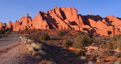
The sunlight does its thing

Wednesday, March 10, 2010

Where the roads run every way but straight

After reading Desert Solitaire in college, I had my heart set on visiting Arches during my post-grad cross-country adventure, yet I somehow only allowed an afternoon for exploration, and that's clearly not enough. I also didn't take into account that Canyonlands National Park is less than an hour to the west of Arches' entrance. On this trip, I didn't overlook that proximity.

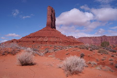
We got ourselves up only a little after the sun -- which wasn't showing through the cloud cover anyway -- and were on the road north through southern Utah and the snow. Monument Valley was dry, if overcast, with just a powdered-sugar dusting across the desert. At the top of the hill at the end of a long stretch of U.S. 163, I pulled over for a few photos, getting a bit of a different view from the one seen in Forrest Gump when he decides he's had enough of the running. In getting out of the car, I feel my foot hit the underside of the dashboard, but think nothing of it. When I get back in the car and close the door, the icon on the dash showing a door ajar remains lit, but with all four doors closed, I cannot determine the source and assume it's a glitch. About 14 miles up the road, when we pause to photograph the rock formation that gives Mexican Hat, Utah, its name, I happen to notice that the hood had been "popped" -- thank God for the latch that serves as a second form of closure. Why the Ford Fusion uses the door ajar light to indicate the hood has been disengaged is another matter.

The road continues to wind around the buttes and mesas, changing elevation and passing through the towns and settlements of Bluff, White Mesa, Blanding (where I believe I stayed back in '98), Monticello (where we doubled back for a picture of Shake Shack's southwestern cousin) and then Moab. We kept driving right out of town, across the Colorado River and past Arches' entrance to Utah 313, turning left and heading west to Canyonlands' Island in the Sky district. We saw few other cars on the road and just one was parked at the visitor center when we stopped to get my passport stamped and use the restrooms -- the first of many pit toilets in our two days in the two parks. As we left the parking lot to drive deeper into the park, the older British couple whose car we saw crossed the street for some photos of the view. We'd encounter them at Mesa Arch and Upheaval Dome, too, but in our roughly four hours in the park, we saw no more than 10 other vehicles.

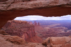
Mesa viewOur first stop, Mesa Arch, offered an easy half-mile loop to the window on a vast mesa below the cliff. Before we left the parking lot, a group of four returned to their car. On the trail, we passed a ranger and a couple heading back to the parking area, saw the British couple arriving at the arch as we were leaving and encountered a couple from the University of Iowa (they each wore sweatshirts declaring as much, and their car advertised it too) as we came around the hill back to the parking lot. None of our subsequent stops would be busier, though Upheaval Dome equalled it.

Though the view from Mesa Arch was breathtaking -- and photos can't convey the vastness, nor the sensation of walking up to the archway and seeing nothing on the other side, at least not less than several hundred feet down -- I didn't realize that we had yet to truly experience Canyonlands. We drove on to Whale Rock, a large, rounded sandstone bulge resembling a half-submerged whale (the above-the-waterline view) visible along the road. Marked as a short hike on the map, we were drawn to it. As we entered the trail from the parking lot, a father and son finished gathering their things and would soon follow us along the path.

Casey went ahead and followed the cairns up and over small humps and hills, through a gulley or two and around the juniper trees. Thinking of the formation as a whale, though the tail isn't visible, we were near the lower third, and as I looked to my left I noticed a cairn atop the great beast's humpback. This trail was taking us to the top of the whale.

Soon we were climbing the long, gradual sloping back of the beast, encountering eroded pools and small clumps of earth deep enough to support a juniper or a few bushes. Having climbed a hundred feet or so from our starting point, we followed the cairns to the left around a steeper bulge atop the rock but had to tread carefully over some loose gravel lest we slip as if on marbles and risk a long, painful slide down the rock to the trees at the bottom. Once around the bulge, we reached the "head" of Whale Rock. A line -- a crack in the rock, or a second formation pushed up against the first -- marked a deliniation between head and body, and the trail before us, as marked by the cairns, suddenly grew steeper. I started up on all fours -- my hiking boots gaining traction on the face of the rock as I went hand-over-hand, leaning forward for better balance. When I got about two-thirds of the way up, Casey paused and sat, unsure about going further. I sat, too, just above her and we looked back at the view before us. We could see our car far below in the parking lot, the road snaking back the way we came and disappearing behind another hill. All else was pockets of snow on red rocks and desert flora.

As we sat there, we began to hear the voices of the father and son we'd seen in the parking lot. They were coming over the higher and steeper hump that we'd walked around. I decided that I'd come this far and wanted to finish the journey, so while Casey said she'd wait for me, I turned and finished my crawl-climb up the rock, needing only a few steps before I felt comfortable enough to stand up. About to tell Casey it wasn't bad at all, I turned to find her right behind me. "When I saw you do it so easily, I couldn't wuss out," she said. "Plus, I didn't want those two to come by and see me sitting there."

Whale Rock summit picAt the top of Whale Rock, we had a vast view. Most of what lie to the north and east was obscurred by nearby ridges, but views to the west, south and southeast were wide open. If we weren't talking and couldn't hear the father and son, who were pleasant when we chatted with them, the only sound in our ears was that of the wind. We were so far from any airport, out of the way of any flight plans, there were no man-made sounds to be heard. We were mere specs on the rugged landscape, miles from any road that didn't dead-end at a cliff or a National Park Service parking lot. A few days ago, I thought the Grand Canyon was silence, but that was only in the middle of the night. Instead, this is silence: Canyonlands, 2 p.m., on a Wednesday. It may not be like this on a June Saturday, but it is on this day and it's noticeable. I love it.

Father and son took a few pictures -- "Dad! Get one of me kicking in the air!" the boy exulted before performing a karate kick atop Whale Rock as his dad snapped away -- and then settled themselves into a depression to shield themselves from the wind and eat their lunch. Moments earlier, we'd discussed together just what Upheaval Dome could be and whether we were looking at it from our vantage point, or if it lay beyond the formations in front of us. I speculated that it sat behind the rocks that rose from just beyond the parking lot at the end of the road that we could see. Casey and I left them to their lunch and descended the whale and returned to our car.

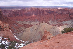
As soon as we parked at the Upheaval Dome parking lot, it was clear that the formation itself indeed lay beyond the rocks in front of us. The trail led up (and we once again passed the British couple) and soon we were standing at the edge of the mysterious cone protruding from an impressive crater. The two main theories on how Upheaval Dome came to be, with the latter believed to be more likely than the former, are a meteor impact or a salt dome.

Upheaval DomeWe had the viewing area to ourselves and then made our way along the ridge for a few hundred feet to gain a different perspective. After a short while, we headed back to the car and encountered on the way six new faces, plus the father and son, who paused to tell us that next they'd be driving to the Aztec Butte trail. "It looks like it will be a similar hike to whale rock!" they told us. As we drove past it, we chose not to explore it for ourselves, and I wonder if they were disappointed not to see our car at the trailhead or encounter us once more along the trail.

Instead we continued along the park road, turning off for the Green River Overlook, speaking softly to each other so as not to disturb the experience for the lone photographer there before us. Yet he is driven out and we soon follow when a 4-Runner full of frat brothers arrives and they talk loudly of impossible feats of agility in descending into the canyon or leaping over a chasm that would surely end in the best possible way: failure.

We continue on to what amounts to land's end in Canyonlands: Grand View Point. Two cars -- one of them sporting a bumper sticker reading "THE DUDE ABIDES," of which Casey must take a picture -- are all we see in the parking lot, and the quartet that abides soon returns to their Subaru and departs. We have just enough time to enjoy the view for ourselves and are returning to our car by the time the five brahs are pulling up.

Grand View Point stood out for me the moment I looked at the park map online, because I recalled Abbey's chapter in Desert Solitaire: "The Dead Man at Grandview Point". I'll let him describe it, because I can't top it:

Looking out on this panorama of light, space, rock and silence I am inclined to congratulate the dead man on his choice of jumping-off place; he had good taste. He had good luck -- I envy him the manner of his going: to die alone, on rock under sun at the brink of the unknown, like a wolf, like a graet bird, seems to me very good fortune indeed. To die in the open, under the sky, far from the insolent interference of leech and priest, before this desert vastness opening like a window onto eternity -- that surely was an overwhelming stroke of rare good luck.

"Jumping-off place," to clarify, is a metaphor for the missing man's passage from life into death; he did not literally jump from the point onto the open mesa of the White Rim. Abbey's brother found him under a tree a mile or so from where he'd parked his car.

And for this day, this chapter of our trip, Grand View Point -- today's maps break it into two words, unlike Abbey -- serves as our jumping-off point, for from here we get back into the car to return to Moab, eager to check into our hotel and walk over to the Moab Brewery for dinner. We're there early, eating in an uncrowded dining room, and I keep an eye on the Notre Dame Big East Tournament game I can see in the bar. Once I see that Notre Dame has a lead, I can tell by the motion on the court when the Irish score or when Seton Hall has the ball. ND puts the game away just as we're putting dinner away.

To enjoy a few more of the house brews, we decamp to the bar, finding two seats on a corner. Soon, a middle-aged man to Casey's left starts chatting with us about Big East basketball and we discuss the conference and the similarities in our backgrounds -- like Casey, he's from Pennsylvania (though the Philly area) and he went to Boston College. He moved to Moab by way of San Francisco and seemed to be enjoying his simpler life. "You know, I've never texted, tweeted or Facebooked," he said, just as Casey and I were wrapping up all three on our phones. We chatted a little about New Jersey too, at which point the shaggy young man to his left and said, "Excuse me, did I hear some discussion about New Jersey over here?"

Casey confirmed his query. "I just moved out here today from Teaneck," he said. Our first night of two in Moab and his first of many, and we each come across someone who lived 15 minutes away back east. Even in the desert southwest, were you can drive for miles on a designated highway and not see another car, even another sign of human settlement, this world seemed just a little smaller.

Late light in Canyonlands

Tuesday, March 09, 2010

Two days on the reservation

Sunset in the Valley

A snow-covered Grand Canyon was charming and adventurous, but it was nice to head east along the Rim Road, make one last stop to gaze upon the emptiness at Desert View, and then descend to Cameron, where Arizona 64 ends at U.S. 89 and you can go south to Flagstaff or north to the Navajo Reservation and Page and the blasted Glen Canyon Dam.

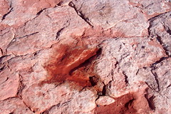
Imagine the talons We turned left to go north on 89 and then east on U.S. 160. Just outside Tuba City, we stopped for 15 minutes to tour the dinosaur tracks petrified in the rock floor of the desert. Our Navajo guide, Delfina (not sure of the spelling), led us across the wind-swept sandstone pointing out the prints left by allosaurus and other "wondrous lizards," though after further research, I don't think we saw more than mere footprints, which are unmistakable (and she didn't try to tell us any were made by Tyrannosaurus rex), so the alleged eggs and the potential skeleton now seem dubious. But that doesn't take away the allure for me; I'd still stop again to look at the prints and pretend that the small round bubbles were once dino eggs.

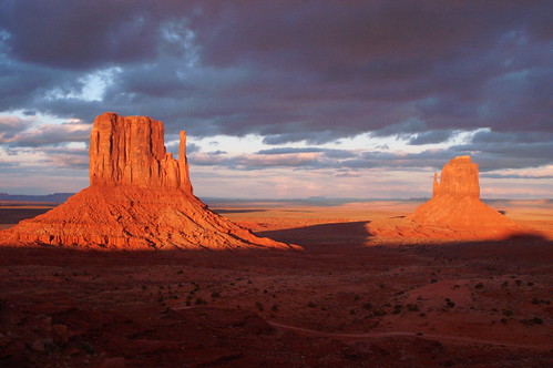
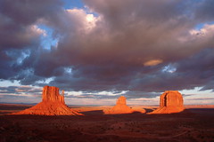
We made a donation and got back on the road, through the towns and not-quite towns of Tuba City and Moenkopi, Tonalea, Cow Springs and Tsegi to Kayenta, which had the last traffic light, gas station, McDonald's and other roadside staples we'd see before crossing the border into Utah ... only to then turn onto Monument Valley Road, cross back into Arizona (no sign this time) and onto the Monument Valley Tribal Park. In a parking lot at the end of the paved road sat a gift shop (or trading post, as they like to call them in the desert), restaurant and The View hotel. A quick check-in had us in our room in time to step out onto the balcony with our cameras to watch setting sun bathe the monoliths across the valley -- the Left (West) and Right (East) Mittens and Merrick Butte -- in the deepest red-orange hues I've ever seen. The sun was setting behind us, over the hotel, and even though the rock formations sat on the desert floor at an elevation below the ridge on which our hotel sat, they reached high enough so that they held the light as the shadows made the long, slow creep up from the floor.

Monument Valley view The sun down, we stepped back inside to organize ourselves, but I returned to the balcony a short time later to get a stronger cell signal to call my parents. As I did, a coyote trotted along the ridge below the balcony, looking up when it heard me and sitting down at one point. The wily guy probably knows to ook for scraps beneath the balconies where the tourists come to gaze at the desert and watch the stars at night.

We walked down to the restaurant for dinner -- our first of three meals there (we brought crackers, string cheese, granola bars and juice with us for breakfast to save a little money since none of the hotels after Sedona offered it for free) -- and agreed that the dry Navajo Reservation would provide a good check for us as far as our alcohol intake. The free refills on soft drinks helped the bottom line as well, especially once we got to Moab and its brewery across the street from our hotel.

Back in our room for my most anticipated night of the trip -- but not for the reasons you may be thinking -- we turned out the lights and stepped onto the balcony to look up at the dome of stars, filling the sky from the horizon to the roof over our heads. I'd requested a room on the third floor, the highest, specifically to have the best vantage point at night. With the help of the Google Sky Map app on my Droid, I could confirm Venus on the western horizon (on the other side of the hotel; we saw it on the way to dinner) and spot Mars and Saturn in the sky above the Mittens. Castor, Pollux, Betelgeuse and more were hanging out up there, too.

I tried my hand at photographing the stars with a long exposure to create trails across the sky, but unfortunately the A/C power adapter that I'd bought for my camera hadn't arrived before our departure (likely delayed en route by some of the snowy weather in late February) and I was only able to take three shots before my three batteries were drained. In a way, though, I'm glad I didn't have it, because I wouldn't have thought to bring an extension cord to reach from the room out to the balcony, so it would have done me as much good as it did being in the post office back in Clifton.

An attempt at star trails With my batteries drained, I couldn't experiment with different settings, so the one shot of the three that was salvagable had one glaring flaw -- my white balance, still set to auto, is (I suspect) the reason pixelated red, green and blue dots appeared on the image. I probably wouldn't have bothered to post it to Flickr (or here) had I not tried looking at it in black and white. The dots are still there, but they don't stand out as much in black and white. At least I had a decent composition and can use this as a starting point for my next attempt, whenever -- and wherever -- it comes.

Loving the idea of spending the entire day in the tribal park, we set the alarms for early the next morning, waking up to step onto the balcony with our crackers, juice and cheese and settling into the deck chairs to watch the sun come up. The opener was just as spectacular as the previous night's closing, with a few clouds streaked in shades of rose and indigo to complement the orange horizon and add depth and variety to the tableau.

Afterward, a nap was necessary, but once we arose for good, we set out for the Wildcat Trail, the only self-guided hike in the park (the others required Navajo guides), which circles the Left Mitten. Though the description on the hotel website and the arrows on the map given to us at the front desk both said to circle the monolith in a clockwise direction, as the Navajo do, yet when we reached the point where the trail circle back on itself, the marker pointed to the right -- counterclockwise. Most of the footprints we followed did the same, and the mileage markers (the whole trek is roughly 3.2 miles, and we'd passed the three-mile marker on the way to the fork) were laid out in the counterclockwise direction. This bugged me throughout the hike and continues to perplex me now, but no ill will came of us as a result of spurning Navajo tradition.

The walk was a true desert hike, over soft, beach-like sand, firm redrock and muddy, adhesive wet clay during one stretch in which the path and a wash through the rabbitbrush and Mormon tea undergrowth were one and the same. The mud caked onto our hiking boots, filling the treads and turning the dark gray of my soles into a deep red to match the ground on which we trod. We stomped our feet on any slickrock we found and picked up a little more mud -- though less adhesive -- over the rest of the trail, but by the time the trail looped around to meet itself, we'd shed all the mud in the coarse, dry, loose sand. "It's a natural exfoliant!" Casey noted.

Mitten side view Around the backside of the West Mitten, as I walked ahead of Casey, hearing only our footfalls and the wind, I thought I caught a comment from behind me. I slowed and asked her what she had said, but she insisted she hadn't uttered a word. "Probably just a rustle of my pants or one of our packs," I surmised. "It almost sounded like a horse's whinny, though." Casey punctuated that statement with a whinny of her own. Yet a minute or so later, just as we were about to resume our walk after snapping a couple photos, we did in fact hear a horse, and turning to the east we saw two of them grazing in the desert, closer to a homestead at the crest of a small hill than to us, but free-range grazing nonetheless. So at least I wasn't hearing things.

The hike finished with a 900-foot climb back to the vacant campground where we'd started, and after shedding our gear in the room, we went to lunch in the restaurant and stopped by the shop so Casey could procure some prickly pear juice. Before leaving for the trip, I considered using this day in Monument Valley to make the two-hour one-way drive to the Four Corners and playing Twister -- one hand and one foot spread out over Utah, Arizona, Colorado and New Mexico -- but after enjoying the comforts of The View and checking the weather report (calling for snow), we ditched that plan and any attempt to take our Ford Fusion rental out onto the 17-mile dirt road through the tribal park and decided we'd earned an afternoon to relax at the hotel.

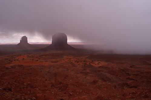
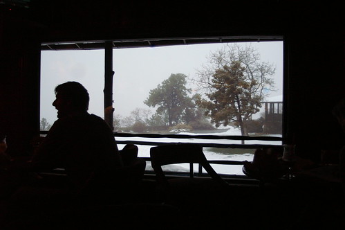
To get out of our rooms, we took our laptops and books (I was re-reading Edward Abbey's Desert Solitaire in advance of our trip to Arches National Park; Casey had brought along Kerouac's Desolation Angels) to a pair of leather chairs and ottomans set in the second-floor traverse past the lobby. There, we caught up on reading, chatted with a few fellow travelers and looked out the windows with regularity as the squalls came through, obliterating the Valley and its formations from view. A few hours later, it was time for dinner and a quiet, lazy evening of TV and more reading as the snow continued and cancelled any star displays for the night.

Snow on The Mittens

Monday, March 08, 2010

Winter at the Grand Canyon

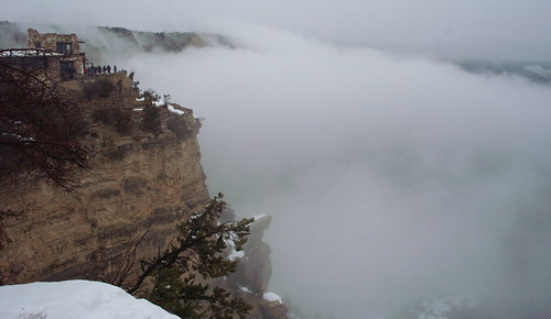
Clouds fill the Canyon

The Grand Canyon is silence.

I woke up in the early-morning hours in our bed in one of the Bright Angel cabins and had trouble falling back to sleep. As I lay there, hoping the next day's weather would improve for us, the compressor on the mini refrigerator in our room shut off, and all was silent. Complete, utter dead stillness. It's an experience we don't get on the East Coast, though I suppose if I lit off for the northern New Jersey Highlands on a spring weekday, I might come close. But chances are, I'd still hear a plane overhead as it makes its way to Newark or I'd still have to block out the whir of the trucks on Interstate 80 or 287.

But at Grand Canyon National Park, should you wake up in the middle of the night, you'll hear nothing, provided your companion is sleeping soundly and not snoring. As I lay there, my ears were off duty. I could hear my breathing, so I held my breath. I heard Casey, sound asleep next to me, but was able to block that out. Maybe a truck went by on the nearby village road, but that lasted a mere moment. Everything else was silence.

The first experience for many at the Grand Canyon is the same: You arrive at the rim and stand there looking out at the Colorado River's handiwork and hear nothing but the wind. At least, if you're lucky. If you arrive with a tour group, you'll have that moment for little more than seconds before someone starts talking. But in many cases, visitors are so taken aback by what they see before them that they treat the spectacle like the cathedral that it is. This trip was my third to the Canyon and I still held my breath upon seeing it again.

That is, when we finally did see it. We left Sedona and drove north on Arizona 89A up through Oak Creek Canyon, gaining elevation with every tick of the odometer. Soon the snow was falling, and it continued, on and off -- but mostly on, until we arrived at Grand Canyon Village. Once we walked through Bright Angel Lodge to the rim, we were met with a wall of white. The Canyon was shrouded in a cloud. We were so high up it wasn't just fog; it was a cloud. Snow continued to fall as visitors milled about, walking the Rim Trial -- at this location a path, paved and wide as it passes several of the lodgings and restaurants in the village.

Casey and I filled the hour until we could check in by walking to the El Tovar Hotel, then back to the Arizona Room at Bright Angel for lunch. Once fed, we returned to the desk to get the key(card)s for our cabin and unloaded the car. Restless and not wanting to sit in our cabin while it was still daylight, not to mention the potential that the weather could clear any minute, we bundled up and set out eastward along the Rim Trail, deciding to walk the 2 1/2 miles to the visitor center. There was no particular reason to go other than to pass the time, enjoy the walk and steal glimpses of the abyss when the clouds allowed, which was not often.

From the visitor center, we boarded the shuttle bus for the return, stepped into a gift shop or two near our cabin and enjoyed a drink at El Tovar's cocktail lounge. Following dinner at Bright Angel's diner, we capped the night at the adjoining bar and watched the last few Academy Awards handed out once they changed the channel from ESPN's worthless NBA game of the night.

After a fitful night's sleep -- mostly excitement at what lay ahead on our vacation, though I did contemplate getting out of bed to write down some of these thoughts when I first had them in the wee small hours -- I woke up and dressed around 6:30, walking over to the rim to see if the weather had cleared. It hadn't, though the overnight snowfall had left a thin coating on any remaining roads and paths that had held off any sticking the previous evening. I returned with a report and Casey and I went back to sleep for a couple hours.

Around 8:30, we awoke for good, bundled up and made our way to the rim. The clouds were parting and offering a limited glimpse into the nearby chasms, but the main vista remained behind the white curtain. The sun, rising behind us in the east, was making an effort to peek through the clouds. Casey and I chatted with a French-Canadian on the trail and we all agreed that by noon, we should have a clearer view.

It didn't take nearly that long. As Casey and I walked westward for 45 minutes, the views began appearing. The white snow, evergreen trees and tan sandstone of the nearby cliffs reached out and then dropped off, but where we had once seen a transition in grays to the white clouds, we now saw further -- to the red formations rising from the bottom of the canyon, to the orange spires reaching to the remaining clouds, to the Bright Angel Trail reaching out and disappearing behind another drop on its way to the Canyon floor.

We made our way to the Trailview Overlook before turning back, packing up our things and checking out of our cabin. Once the car was packed, we boarded a shuttle bus westward, disembarking at Mohave Point for a prime view of the Colorado River winding below us. From there, we began our trek back east, following the Rim Trial when we could -- often walking on top of the packed snow, sometimes punching through drifts up to our knees, occassionally losing the trail completely and trudging up to the road to walk along the asphalt. Though not a full Canyon hiking experience, we prefered the potential hazard of a shuttle bus along the road than a slip off the trail -- if we were even on the trail -- into the Canyon itself. Our efforts took us back to Powell Point and the marker commemorating John Wesley Powell's navigation of the Colorado River all the way from Wyoming through Colorado, Utah, Glen Canyon and the Grand Canyon. There, we hitched a ride back to the village on the shuttle, ate lunch at El Tovar's main restaurant and got back in the car to head off on our next part of the adventure: Monument Valley.

Happy hour at El Tovar

Sunday, March 07, 2010

A new view of Sedona

Sedona beneath the rocks


My first visit to Sedona was in June 1999, when Bryan and I stopped in between Flagstaff and Phoenix. We were in Arizona for the first wedding among our college friends, just 13 months after graduation, and decided to make a brief vacation out of it. We landed in Phoenix on a Wednesday, drove to Flagstaff, toured the Grand Canyon on Thursday, then stopped by Sedona on Friday on our way back to Phoenix. We slid at Slide Rock in the morning -- the sun hot, the water frigid -- bounced up into the red rock hills on a jeep tour (not a pink one) in the afternoon and sped south on I-17, arriving back in Phoenix for dinner and to meet up with the rest of our friends arriving at Sky Harbor Airport.

The Sedona I remembered based on that brief visit was a quaint mountain town rimmed by the picturesque vermillion cliffs, an artsy community with galleries and boutiques along Main Street -- not its real name -- overlaid on an outdoorsy, mountain hamlet inhabited by hikers and fat-tire enthusiasts, the crunchy granola set. So either Sedona has changed a bit in the last 11 years, or my brief glimpse kept me away from the reality. The 2010 Sedona I saw was closer to Orlando than Boulder, the town I've since learned fits my memory of Sedona much more than actual Sedona does now.

Casey and I stayed in the western end of town, along Arizona 89A after it bears right once you leave downtown as you're traveling from the north. The highway out by our hotel is nothing like the two-lane center of town; outside the shopping district it becomes the strip-mall district, a four-lane thoroughfare lined with chain stores and restaurants with a few touches of local flavor to provide some variety. I had no idea this end of town existed, so when Casey was scouting hotels, I encouraged the affordable and let her research the options. I figured the west end was an extension of downtown, that the Days Inn would be nestled in with other budget lodgings yet still maintaining Northern Arizona charm. Sedona had come highly recommended to Casey by some friends, and I paired those recommendations with my memories. It occurs to me now that maybe those friends hold different opinions on what makes for a quiet, enjoyable vacation spot.

After checking in, we drove downtown and walked both sides of the main street, ducking into a few shops when the window displays -- or the varietys of jerky -- drew our attention. During our stroll, though, we stumbled into the hidden Sedona, the part that I hadn't seen before and that erased much of the charm for me. After turning down the first time-share hawker who addressed us ("Hi, you folks just get into town?" was enough of a warning), I was fooled by the next guy. He was nice enough, and I don't remember exactly what he said that caused us to detour into the alcove and stand at his desk while he pulled various brochures tried to sell us on a 90-minute time-share presentation the next morning in exchange for discounted jeep tour tickets, a free romantic candlelight dinner or a great deal on a scenic train ride in the mountains near Jerome. He had an answer for every activity we threw at him in an attempt to end the spiel, asking only that we show up at the resort south of town at 8:30 the next morning. By 10, we'd be free to begin our excursions, but with a free two-night stay at one of their 170 worldwide resorts for our time. We turned out to be one tough sell, and he finally gave up when we convinced him that, in fact, yes, we are the kind of people who enjoy waking up in the morning, taking our time over breakfast gauging the weather and our gut feelings before deciding where the day will take us.

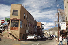
In the hills around JeromeSaturday did take us to Jerome, but I don't recall any train tracks or engine whistles. We wouldn't have considered watching the mountains from inside a passenger compartment, nor on a bench of the open-air cars. I may hop aboard the railroad at Disney World to see the park or get from Frontierland to Toontown, but on my one visit to Jerome, I'd prefer to get closer to the sights. So we began by driving straight through town to the "ghost town" at the old Gold King Mine. It's a ghost town in the same way that the Olive Garden is authentic Italian food -- because they say it is and they charge you for it. And while it may be a ghost town out of a Scooby Doo episode, where it takes an active imagination to see the thrill in it, we were OK with that. Mostly an assortment of rusting cars and trucks, some mining equipment and a collection of shacks and buildings that once may have been used for blacksmithing, wood cutting and other old-timey pursuits, it is at least set up around the long-closed entrances to the mine. We enjoyed our hour perambulating over the hills among the Studebakers and farm animals -- two penned-in goats, a flock of chickens and roosters scurrying about, a donkey that knew to ring its bell in hopes of food and a gray bunny that had dug itself a nice little trench in the dirt beneath a plow. It all began with a pleasant welcome from the in-character "miner" who bore a striking resemblance to Frank the Tank's boy, Blue, and who, when told we hailed from New Jersey, replied, "I've heard of that place. You don't live in Camden, do you? Or Newark or Paterson?" While we're close to Paterson, we assured him our neighorhood is far from the mean streets.

The Flatiron Cafe We returned to downtown Jerome for lunch, eating what may be the best nachos I've ever tasted at Quince (the pulled pork put them over the top) and pausing at various historical markers on the buildings -- or what was left of them. Jerome is what I thought Sedona was, a tourist destination of shops, galleries, museums and eateries, but without the trap-like commercialism of chain resorts or golfing vacations. Many of the original buildings from the boomtown days have been renovated and re-opened as similar businesses -- the brothel as bar -- while others stand as a literal shell of their former selves, a plaque and a photograph provided to give us a glimpse at the glory days.

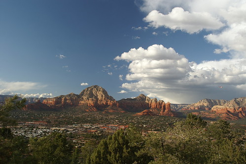
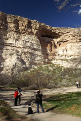
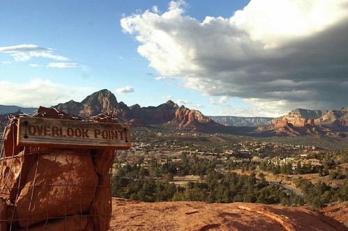
Finding the right spotOnce descending Cleopatra Hill, we doubled back beyond Sedona for a quick visit to Montezuma Castle National Monument, a Native American cliff dwelling carved into the limestone along Beaver Creek. It was a short visit that allowed me to add a stamp to my National Parks Passport and made the purchase of an annual pass worthwhile -- the $5 per person put us at $55 for the trip (Grand Canyon will be $25, Canyonlands and Arches $10 each), so $80 for admission to the National Parks System over the next 364 days seemed like a wise financial choice. It's a well-designed program -- the back of the card holds lines for two signatures, so Casey and I each signed it, allowing either of us to use it for admission to any of the parks, monuments or landmarks under NPS jurisdiction. And for areas like Montezuma's Castle, where admission is per person rather than per car (and for seven days at that), the pass covers the bearer and up to three guests. The ranger explained a local benefit of the pass, which doubles as a Red Rock Pass for hiking in and around Sedona. We used it after leaving Montezuma, driving up to the airport for an aerial view from Overlook Point. Saved another $5 there, putting us at 20 bucks before it's all gravy until March 5, 2011.

Dinner that night was at the Oak Creek Brewery, where we walked in to find two seats at the bar and the Gold Lager to our liking before calling it a night. With snow in the forecast for the next day, I wanted to make sure we had enough time to get to the Grand Canyon well before nightfall.

What it is

Wednesday, March 03, 2010

All the things I thought I'd figured out I have to learn again

A little over a month ago, Uniwatch pointed to a post about the right way to tie your sneakers. And when Verlyn Klinkenborg wrote about it yesterday, I decided to chime in with my review: It works!

Like Klinkenborg, I had no idea I was doing anything wrong. Of course, I also had some sort of mental block or performance anxiety about tying my sneakers as a kid. I can vividly recall not only asking parents -- mine or my friends' -- to tie my shoes when they became undone well into my school years, but I also seem to remember Sue, the mother of my best friend, Matt, being particularly proud when I no longer had to ask her for assistance.

But this revelation came to me at a particularly fortuitous time, for the sneakers I've been wearing as my everyday footwear for the past several months have a rounder, more slippery lace that tended to come undone more easily than any in recent memory. To wit: There were days when I couldn't even make the third-of-a-mile, eight-minute walk from the house to the train station without having to stop to tie one sneaker or the other. Once I started trying the new method -- the Reef Knot -- I saw an immediate improvement. Now, I have to stop maybe once a week to re-tie a sneaker between the time I put them on and the time I get home and remove them. And like Klinkenborg, I found that the first several implementations required me to think about what I was doing, how I was tying my shoes. It's becoming more natural of late, but there are still times when I have to pause when I bring the one free lace over the formed loop and create the second loop.

Despite the knot's usefulness, I won't be getting any more New Balance with these laces in the future -- and I'll be sure to think the colors through. When I bought these, I saw them as blue and gold -- Notre Dame colors. When I finally put them to regular use, they seemed blue and yellow -- Michigan colors. Ew.

Maybe the lace slippage is just what I get for my tradition in recent years of buying anything with a decent (read: not garish) design in my size at a discount at the LL Bean Outlet in Freeport. This pair was the last I'd stockpiled in the past several years. I'll be due for new kicks when spring arrives (I prefer to stick with the current/old shoes through the slushy snowmelt and, depending on the year, April's showers, then break out the new ones when the weather turns warm) and for the first time in a long time, I don't have a pair stored away. With no trip to Maine planned as of yet for this year, I'll try the Nike outlet in Paramus or see what deals I find in some of the local stores.

No matter the brand, though, I'll be employing the Reef Knot after this success.